Vintage Map of Oxford University, 1950
Vintage Map of Oxford University, 1950
Couldn't load pickup availability
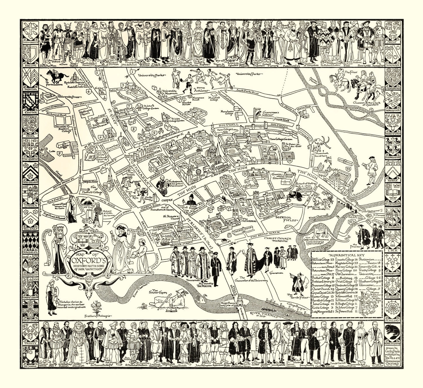
The only non-American map in the collection. A 1950 aerial of Oxford when C.S. Lewis, Tolkien, and the Inklings still met weekly at the Eagle and Child.
Founded around 1096, Oxford is the second-oldest continuously operating university in the world and the oldest in the English-speaking one. This 1950 map captures postwar Oxford — rationing still in effect, the colleges beginning to reopen fully after wartime use, and a literary circle at Magdalen that would produce The Lion, the Witch and the Wardrobe that same year. The "dreaming spires" (Matthew Arnold's phrase) are all there: Magdalen Tower, the Bodleian, Christ Church, the Radcliffe Camera.
Faculty across the humanities — history, philosophy, classics, English, theology — tend to have an Oxford affinity regardless of where they studied. The most visually dense map in the catalog.
DETAILS
- Source map: 1950, Oxford, England
- Cartography: Aerial perspective
- Print sizes: 12×18, 18×24, 24×36, 32×48, 40×60 (varies by option)
- Finishes: unframed print, black frame, walnut frame, natural frame, canvas
ABOUT TED'S VINTAGE ART
Ted's digitally restores historic maps and prints each piece to order. Framed versions use solid wood with UV-protective glass; canvas prints are stretched over solid wooden bars. Because each print is made when you order it, allow a few extra days for production.
Share