Vintage Map of University of Pennsylvania, 1933
Vintage Map of University of Pennsylvania, 1933
Couldn't load pickup availability
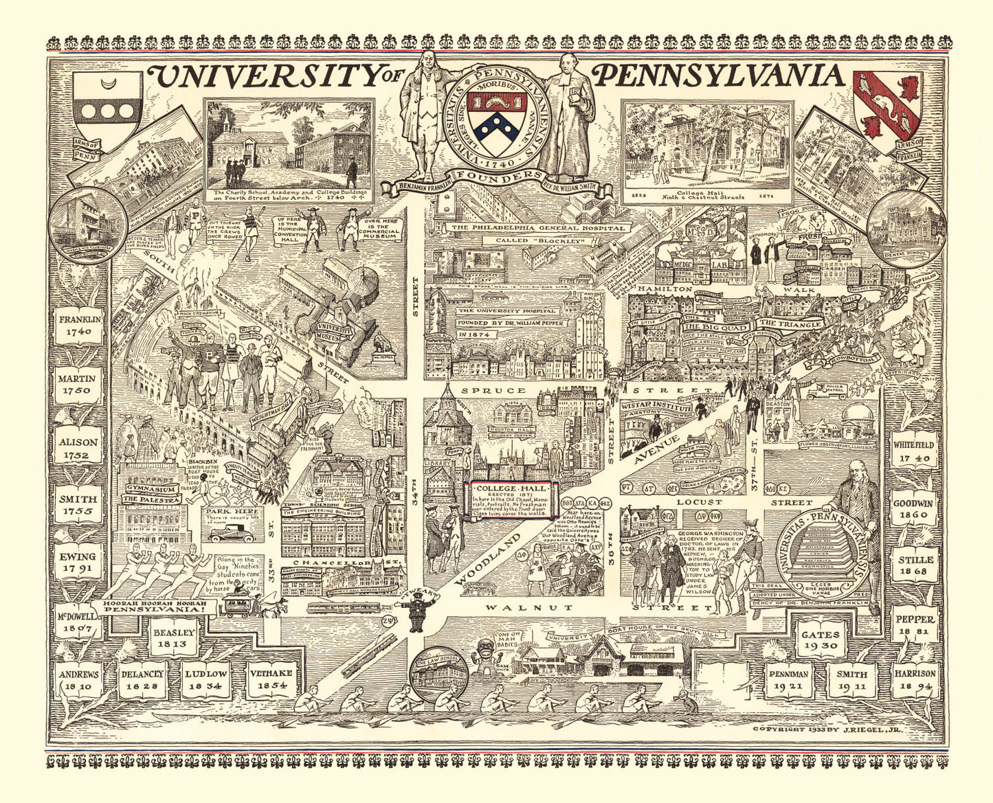
A 1933 aerial of Penn's West Philadelphia campus — Franklin's university in its Depression-era form, urban and densely built.
Founded by Benjamin Franklin in 1740, Penn is the oldest Ivy chartered before the Revolution and the first American institution to call itself a university. This 1933 map captures the West Philadelphia campus after its consolidation — College Hall, the Quad dormitories, Franklin Field, the Furness Building housing the library — at the density and scale that still defines Penn's urban character. A different visual register than the pastoral Ivy campuses: streetcars, row houses at the edges, the city pressing in.
For Wharton alumni, law faculty, medical faculty, and historians of American higher education, the Philadelphia density reads as authenticity rather than limitation.
DETAILS
- Source map: 1933, Philadelphia, Pennsylvania
- Cartography: Bird's-eye aerial perspective
- Print sizes: 12×18, 18×24, 24×36, 32×48, 40×60 (varies by option)
- Finishes: unframed print, black frame, walnut frame, natural frame, canvas
ABOUT TED'S VINTAGE ART
Ted's digitally restores historic maps and prints each piece to order. Framed versions use solid wood with UV-protective glass; canvas prints are stretched over solid wooden bars. Because each print is made when you order it, allow a few extra days for production.
Share