Vintage Map of Princeton University, 1906
Vintage Map of Princeton University, 1906
Couldn't load pickup availability
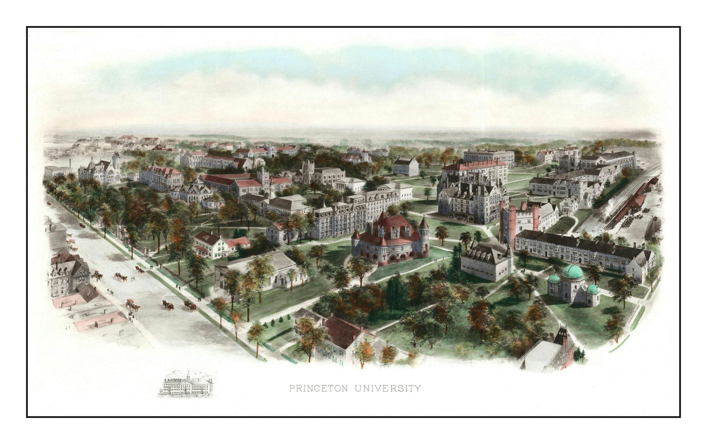
A 1906 bird's-eye of Princeton at the peak of the Wilson era — the year the preceptorial system was launched and the modern research university began taking shape.
Chartered in 1746 as the College of New Jersey, Princeton in 1906 was in the middle of its transformation under then-president Woodrow Wilson: the preceptorial system was introduced that year, small-group teaching became the campus signature, and the Collegiate Gothic building program was underway. The bird's-eye perspective captures Nassau Hall, the open quads, and the tree-lined axis down to the Dinky — Princeton as it existed right before the 20th century arrived in full.
One of the two earliest maps in the collection (Yale 1906 is its peer).
DETAILS
- Source map: 1906, Princeton, New Jersey
- Cartography: Bird's-eye aerial perspective
- Print sizes: 12×18, 18×24, 24×36, 32×48, 40×60 (varies by option)
- Finishes: unframed print, black frame, walnut frame, natural frame, canvas
ABOUT TED'S VINTAGE ART
Ted's digitally restores historic maps and prints each piece to order. Framed versions use solid wood with UV-protective glass; canvas prints are stretched over solid wooden bars. Because each print is made when you order it, allow a few extra days for production.
Share